Where and how do we begin?
STATION 1 of the GREENMANVILLE SELF-GUIDED TOUR

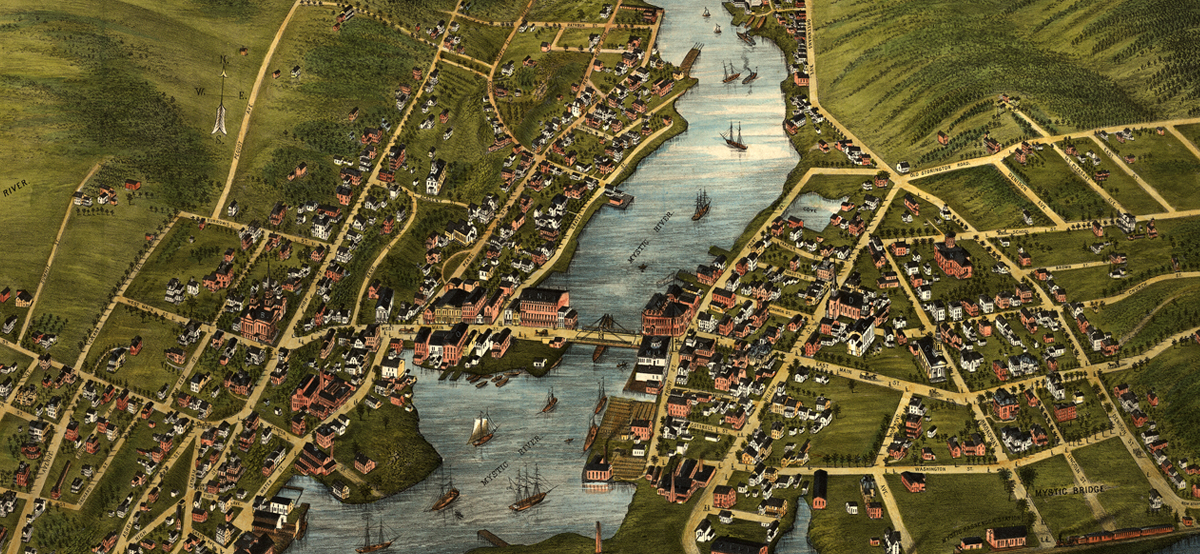
Pictured above: View of the 1879 map of “Mystic River and Mystic Bridge, Conn.” from the Mystic River Historical Society.
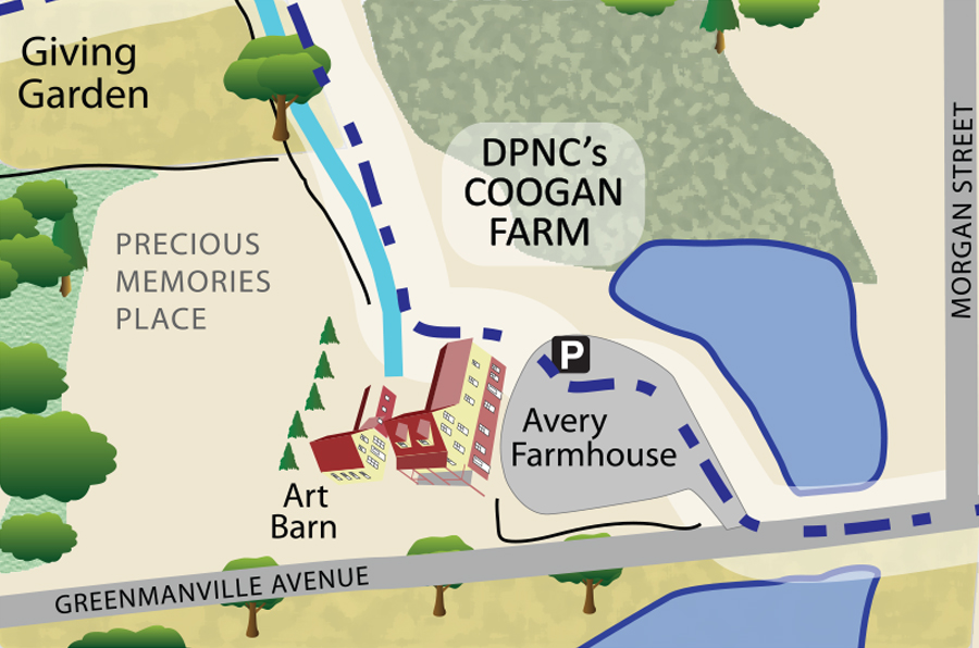
The Greenmanville Trail is a self-guided walking tour, beginning at Avery Farmhouse on the Coogan Farm campus of the Denison Pequotsepos Nature Center. How we begin our tour requires further context and acknowledgement of who came long before the Greenmans. Mystic or Muhsáytuk (muh-sigh-tuck) describes the river here, and is a word originating from the southern New England Algonquin language translating to “great flowing water.” This pleasant, pastoral river was close to the heart of Pequot territory and one of the Pequot’s principal villages in the area. In 1637, this land was forcibly taken from the Pequot people in what was recounted by surviving descendants as genocidal warfare. According to the Mashantucket Pequot Museum & Research Center, the massacre at Mystic, or Pequot Hill in view to the west, killed between 400 and 700 Pequot men, women and children leading to the eventual claim of the land by the English and formation of the state of Connecticut.
What once was a landscape of homeland and harvest became dispossessed of a people generally not included in modern society or historical accounts. A monument celebrating Captain John Mason was erected on Pequot Avenue in Mystic in 1889, further compelling erasure of indigenous existence and contribution to the understanding of our natural world and our relationship as a part of it. The Mason statue has since been removed; however, recognition and presence of the Pequot people within this sacred landscape remains incomplete.
Two hundred years after the landscape was tended by the Pequots, the Greenman brothers purchased 12 acres to establish their shipyard on the Mystic River. As viewed in the 19th-century, this five-mile stretch of water held “multiple sites for natural shipyards” widening to the south and narrowing to the north. In the following years as Greenmanville sprang to life, land to the north became the Greenman woolen mill– still standing today as part of Mystic Seaport Museum, and in 1853 the Greenmans purchased the riverside acreage now known as Coogan Farm. From historical accounts, we know that the land had “orchards of the best fruit” and continued in use as homeland and harvest with corn, potatoes, root vegetables, oxen, dairy cows, pigs, sheep, poultry and fruits from the orchard for the Greenmanville community.
The moral awakening of the 1800s motivated social action within local community life. The Greenmans earned a living from shipbuilding, textiles, manufacturing and farming, while trying to navigate the complexities encountered during the pursuit of equality. The world was advancing at a fast pace as observers of social justice and reform such as the Greenmans knew well. Tensions between perspectives in the Greenmanville community in 1870s and 1880s inflamed, causing injury and loss of property. According to newspaper accounts, the burning of barrels of rum captured in Mystic became a public spectacle on the Stonington Commons in 1883, demonstrating that different perspectives have always been a challenge of the human condition.
Exploring the layers of landscape
As we continue to follow the Greenmanville Trail and explore how Lifeways (people), Foodways (food) and Greenways (nature) intersect at Coogan Farm, please walk up from the John Avery Farmhouse parking lot towards the pentway leading to the heart of the property. An entrance to a gravel road is highlighted by the remains of an old barn foundation and framed by old stone walls. Many of the existing stone walls on the property were constructed during Greenman ownership of the farm, but some are known to be much earlier and possibly attributed to indigenous labor.
Along the initial ascent of the old farm road is an American Ash tree on the north side dating to the 19th century. Prior to this tree, others may have existed here on this land. The Ash tree was and is considered sacred by the Pequot people. The Black Ash tree or Môyôkus (moi-yunk-us) means “weaving tree” in the Pequot dialect of Algonquin and is considered to be “animate.” Wood strips from these types of trees were and still are used in basket making. Long considered utilitarian objects by many cultures, basket making continues as a rare skill generally using a variety of materials found in nature. The Nature Center is treating this specimen of American Ash tree for the invasive beetle known as the Emerald Ash Borer (Agrilus planipennis or EAB). We hope to prevent further destruction or the demise of this tree as has been the fate of tens of millions of Ash trees since the arrival of EAB to North America in the early 2000s.
The Greenmanville Trail continues along the farm road past the large Giving Garden, herb and pollinator areas at Coogan Farm, which is reminiscent of the civic-minded approach to farming applied by the Greenmans. In the 19th century, the Greenmans operated a store that carried a selection of farm goods for the neighborhood and recognized credit, cash, trade and work for goods from their store according to account books held by Mystic Seaport Museum. Evidence of community members keeping farm animals at the farm, as well as renting out oxen and horses for plowing and clearing fields, has been found in historical documents.
Greenmanville appears to have been a strong maritime and agricultural community caring for each other. We are energized to emulate this positive leadership style for the health of all living things. Today, we practice regenerative farming on the land to improve the health of the soil and nutritional content of the produce, which is donated to help feed the food insecure of New London County. Less than two percent of the United States population is now employed in any type of farming– leading to concern for our food supply as well as the overall health of our ecosystem(s).
Share the Greenmanville Trail web tour!

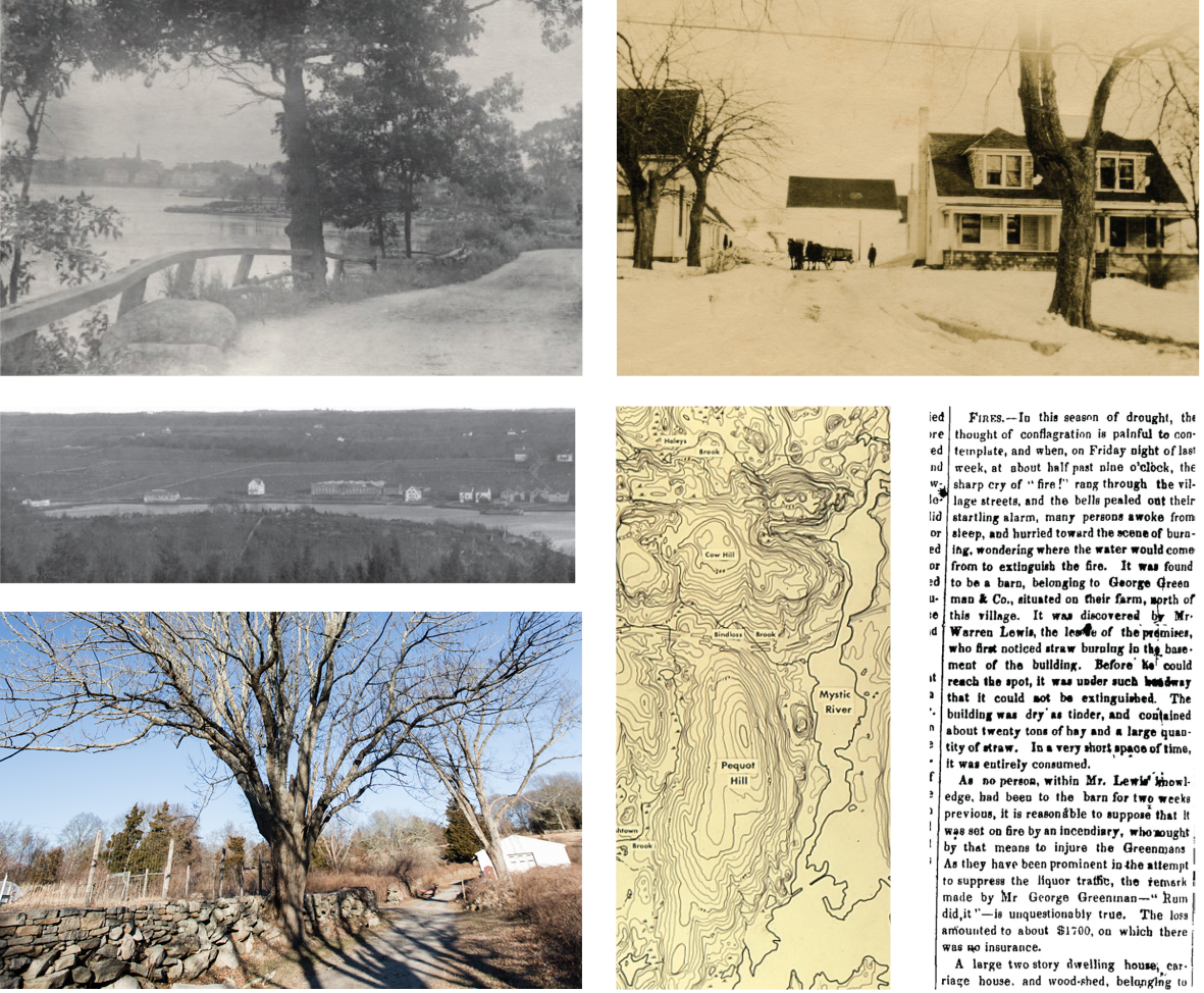
Pictured above: (Top left) Undated black and white photo of Mystic River off River Road from the Mystic River Historical Society (MRHS). (Middle left) View of east side of Mystic River, ca. 1900, taken by Everett Scholfield from his home on Clift Street. (MRHS, Stinson Collection). (Bottom inner right) Topography map of the Pequotsepos Valley from the Mashantucket Pequot Museum & Research Center. (Top right) Photo of Coogan Farm from the early 1920s showing the meat market, barn and farmhouse from the MRHS. (Bottom outer left) Image of the Ash tree by the Giving Garden estimated to be more than 200 years old. This incredible specimen continues to provide an excellent canopy and nesting area for wildlife. (Bottom outer right) Article from page two of the Mystic Journal dated Saturday, September 24, 1870, from the Stonington Historical Society.


