Pasturelands and Orchards
STATION 2 of the GREENMANVILLE SELF-GUIDED TOUR

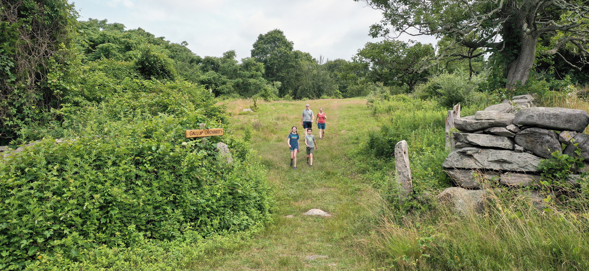
Entrance to the heirloom orchard at Coogan Farm, where you can wander amongst over two hundred revived pear and apple trees. Photo by Mark Starr.
Topography is an important part of the success and survival of a landscape. Besides being situated on the Eastern side of the Mystic River by fertile marshes and forest, the land here benefited from what local historian Rudy Favretti called “good slopes and airflow” that made it fitting for grasslands and meadows used for pasture and fruit trees. Probate records as far back as the late 1770s indicate that pastureland and orchards were part of the acreage to be sold and noted the presence of stone walls on the property.
In Euro-American history, the farm was once a part of a large land grant, eventually compromising 500-acres, to Captain John Gallup in the mid-1600s (https://gallupfamilyassociation.org/) for military service rendered against the Pequot Nation in what was known as the Pequot War. Historical accounts also provide evidence that both John Gallup, Sr. and the son of the same name, identified the body of John Oldham, an English trader slain at Block Island. This pivotal discovery provoked tensions leading to the attack on the Pequot Fort or what is known as the Battle of Mystic occurring on May 26, 1637. Captain John Gallup would later lose his life leading troops into Narragansett territory in 1675 during the Great Swamp Fight in Kingston, RI– perhaps considered even more brutal than the Battle of Mystic causing massive loss of life and further erasure of indigenous homeland. For more than a century beyond these tragic consequences of colonialism, the farm remained in the possession of the Gallup family and was cultivated as cherished landscape as it had been before by the Pequot Nation.
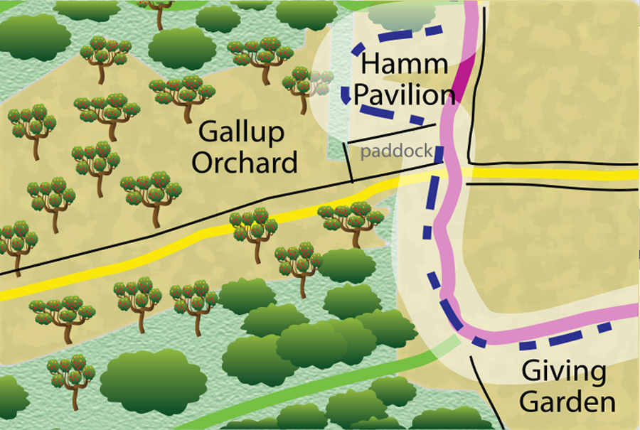
Following the route of the tour, the Gallup Orchard is signed off the main loop around the farm accessed by heading up the hill beyond the Craig Floyd Giving Garden. Here you may choose to meander through the side trails of the heirloom orchard with approximately 15 acres of apple and pear trees– some descended from the original 19th-century roots and others grown as seedlings from generations long past and of unique variety. The Nature Center is restoring the health of this orchard while creating habitat where pollinators and wildlife can continue to thrive.
The dwellings previous to the current farmhouse at 162 Greenmanville Avenue would have been somewhere in this area and are alluded to in historical records. Identification of exact locations of these structures remain unknown. Further archaeological excavations could lead to the discovery of artifacts of Euro-American significance as well as that of the indigenous peoples prior to Euro-American contact. The possible layers of learning that lie beneath this preserved landscape are astonishing and of the utmost value to our future understanding of shared stories of land and people.
Share the Greenmanville Trail web tour!

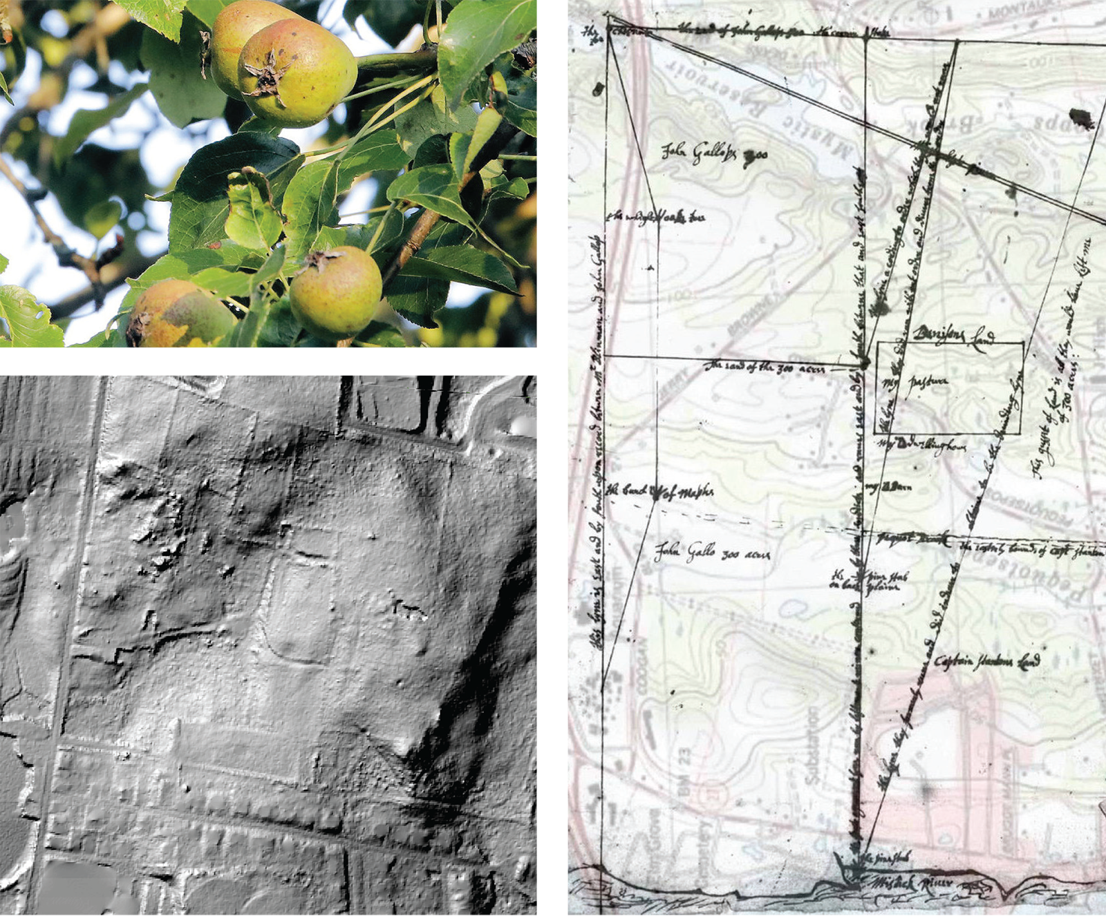
Pictured above: (Top left) Several varietals of apple and pear trees have been discovered during the restoration of the orchard. The oldest of these trees are estimated to be a century or more in age. One apple tree in particular was identified as containing the lineage of some of the earliest russet cultivars found in the country. The heirloom orchard also contains Asian and European pears that have produced hybrids and early testing suggests they represent rare varietals, as well as possible new cultivars. (Right) Map of old land boundaries for the Gallups and Denisons over recent topography map from the Coogan Collection, Mystic River Historical Society. (Bottom left) LiDar image taken in 2015 during an archeological investigation of Coogan Farm in conjunction with the University of Connecticut. Indicates a possible area of interest for the location of the original Gallup homestead, which may have been located just to the left of the current entrance of the heirloom orchard.


